


Traces Left in the Mountains?
Hong Kong people love outdoor activities, yet they rarely notice that hiking trails need care and preservation.
In recent years, irresponsible hiking behaviors—such as littering, climbing fragile rocks for photos, and damaging precious plants—have gone viral on news and social media, serving as warnings to hikers. But have you ever considered that our frequent footsteps alone can also contribute to trail degradation?
As outdoor activities grow in popularity, trail deterioration accelerates, making it crucial to address this issue early. The Green Earth has visited multiple hiking trails, using aerial photography to observe changes in the landscape, analyse the causes, and spark discussions on how to preserve the natural beauty of our countryside paths.
Tai Tong Thousand-Island Lake - Reservoir Islands Viewpoint
|
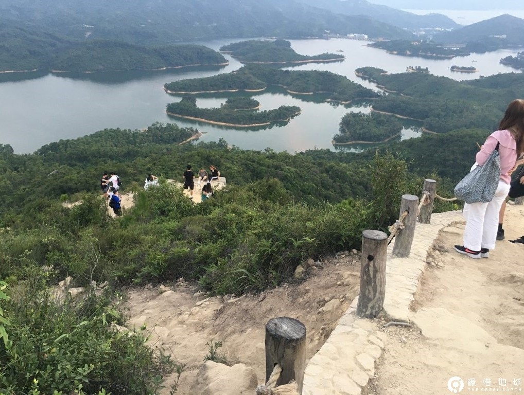
Opened to the public in March 2019, Reservoir Islands Viewpoint offers breathtaking panoramic views of Tai Lam Chung Reservoir, often referred to as "Thousand-Island Lake." Since its inauguration, it has become an immensely popular outdoor photography spot, frequently bustling with visitors. Even during the pandemic, the steady flow of tourists remained uninterrupted, making it a year-round attraction. |
 |
 |
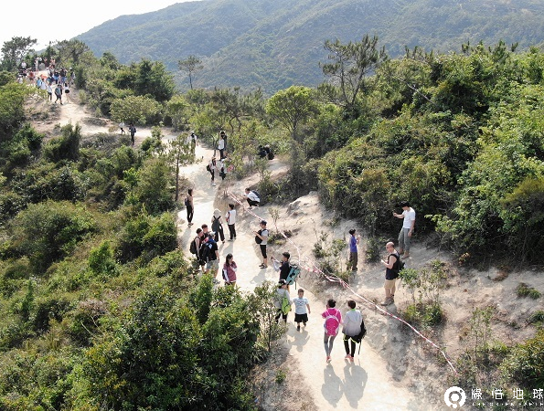
Despite the already stunning views from the viewpoint, many visitors have stepped beyond the safety barriers onto large rocks to take photos for a "better" position. Over time, multiple "photo-taking trails" have formed along the slope in front of the terrace. Within a year, these paths have widened, causing soil erosion and diminishing the viewpoint’s original appeal. This has, in turn, encouraged more people to seek out their own ideal viewpoints, further impacting the landscape.
Reservoir Islands Viewpoint
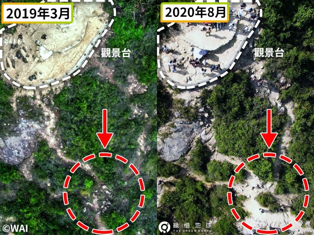 Photo Credits:WAI
From aerial photos, it's evident that within a year, the small trails outside the fence of Reservoir Islands Viewpoint have significantly widened and become eroded, exposing the underlying rock.
|
Caught up in the moment, some visitors stand on the slopes beside the trail, where plants once thrived, to take photos. Some even climb trees for a better shot, causing the original vegetation to gradually disappear and the area to turn into barren, sandy ground. |
|
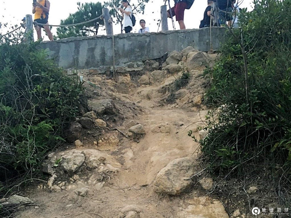
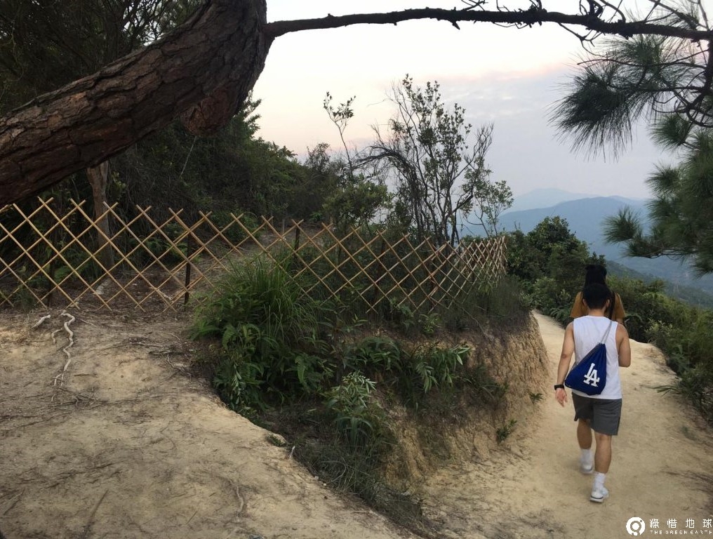
The fence barrier was installed to protect newly planted saplings and prevent visitors from accidentally stepping on them. Constructed in late July this year, the barrier has effectively deterred people from entering the restricted area, ensuring that the young trees remain safeguarded.
|
Can you stay at the viewpoint and enjoy the scenery?
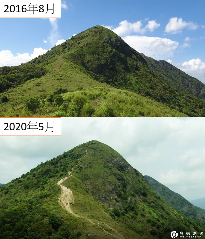
Dragon's Back
|
Dragon’s Back is an internationally renowned hiking trail that was once selected by Time magazine’s Asia edition as the "Best Urban Hike in Asia."
Among the various sections of the Hong Kong Trail, Dragon’s Back stands out as the only one that completely escapes the city's towering skyscrapers while offering breathtaking panoramic views of the deep blue ocean. This unique combination of serenity and scenery makes it a beloved hiking route among both local and international visitors.
|
|
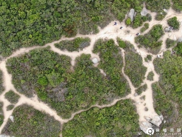
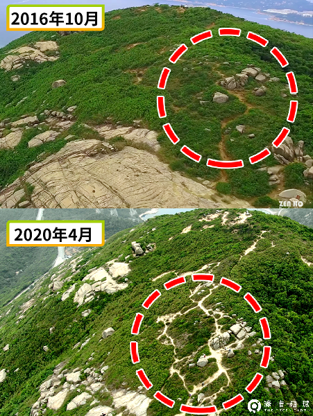
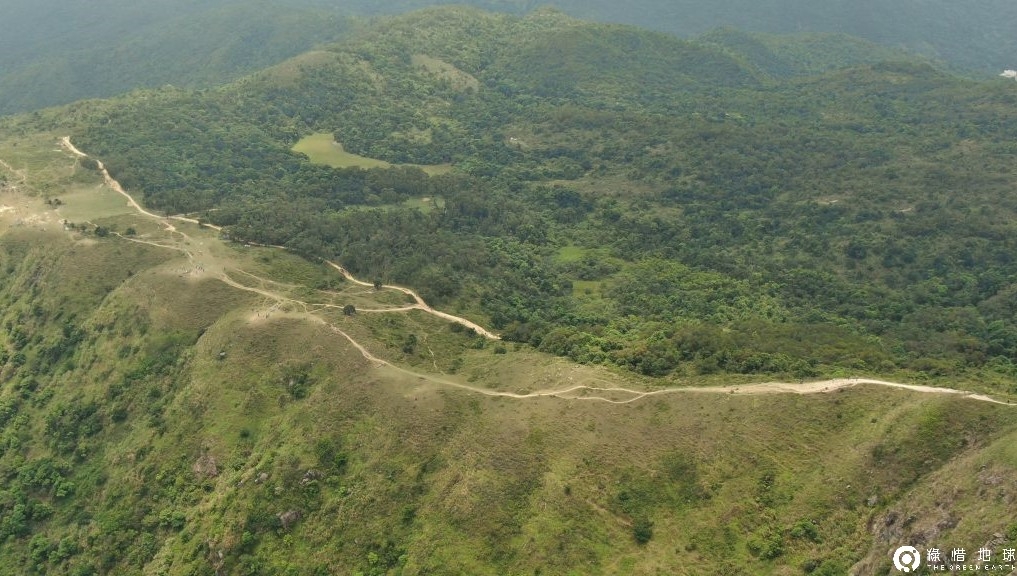
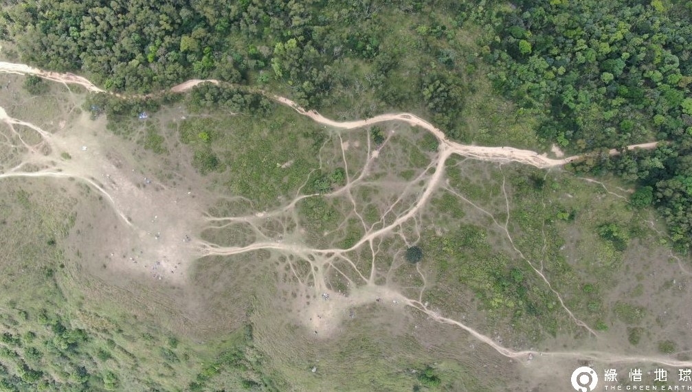
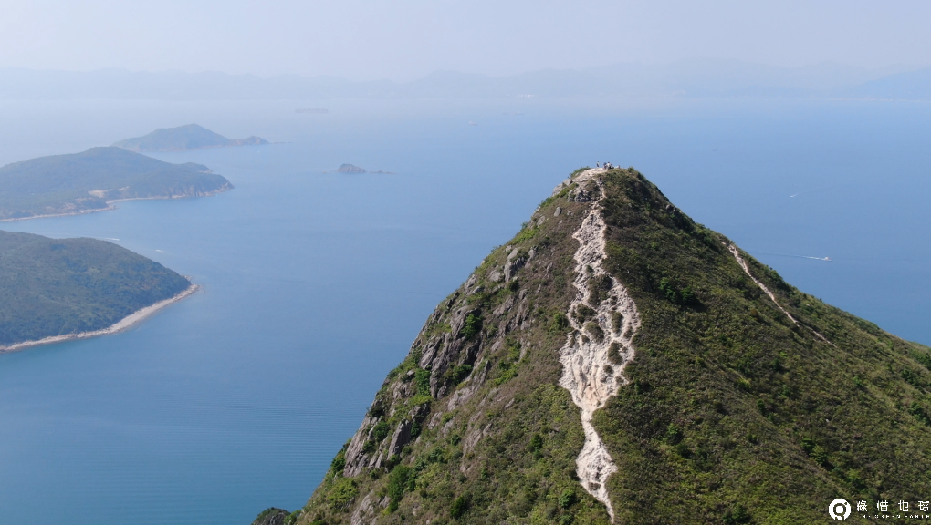
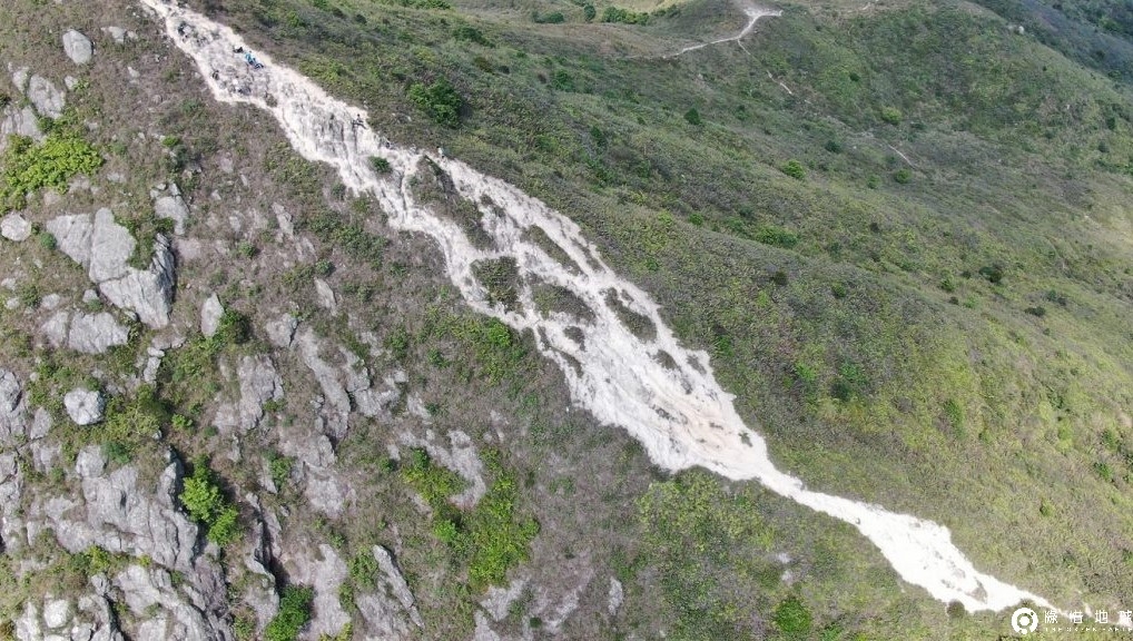
The southern slope of Dragon’s Back is not part of the official Hong Kong Trail route, meaning it does not fall under regular maintenance by authorities. However, in recent years, visitors searching for the perfect photo spot have carved out a spiderweb-like network of unofficial paths across the slope. |
|
The footprints left by visitors fragment the vegetated slope, gradually leading to vegetation degradation. Over time, this deterioration may ultimately turn the hillside into barren land.
|
|
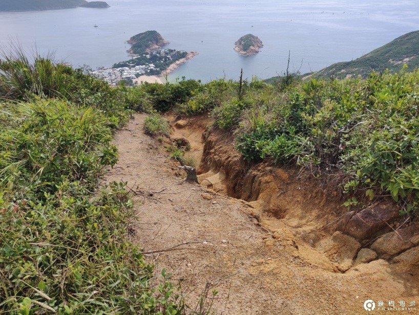
Without plant roots to hold the soil together, rainwater follows the paths carved by heavy foot traffic, eroding the landscape. Combined with the area's fragile granite-based soil, some of these unofficial trails eventually transform into deep gullies, reaching depths of up to one meter. |
|
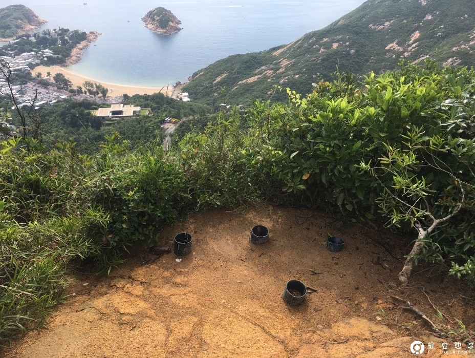
The harsh coastal winds make it difficult for most plants to thrive in this area, resulting in low-growing vegetation dominated by shrubs and grass slopes. Once damaged, restoring the plant life becomes a significant challenge. Recently, the Agriculture, Fisheries and Conservation Department (AFCD) attempted to replant vegetation along severely eroded trails, but the effort has not been entirely successful. The poor environmental conditions pose a major obstacle, and newly planted saplings are often trampled by visitors, preventing effective restoration. |
|
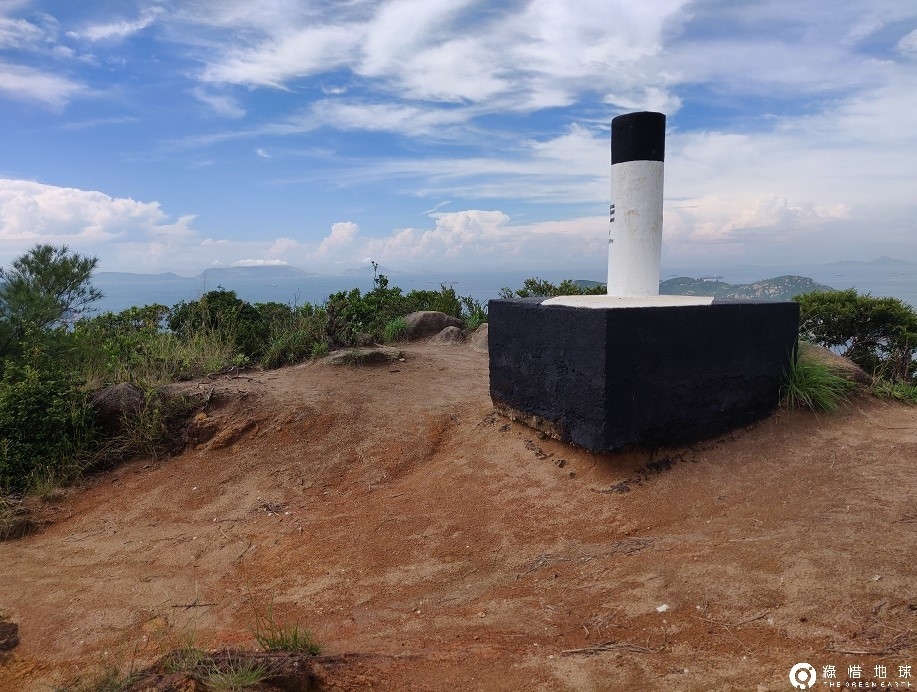
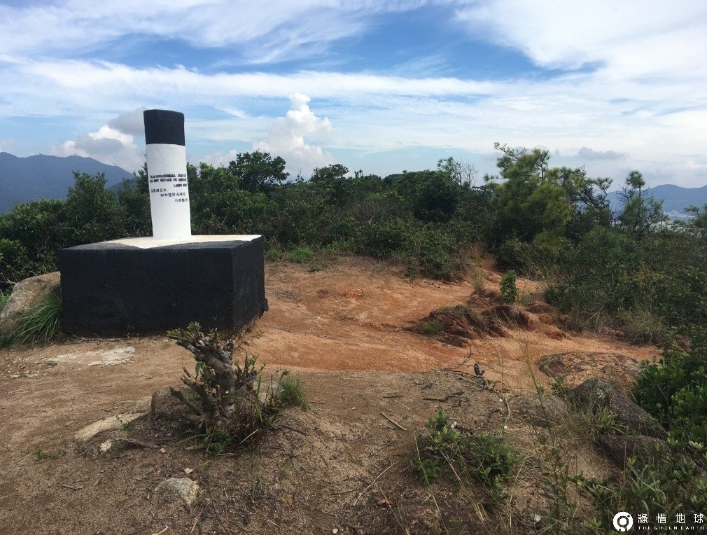
At the high point of South Dragon’s Back, severe soil erosion is evident, with significant loss of topsoil. The ground beneath the Trigonometrical Station has also been eroded away, leaving a noticeable missing section. |
|
Soil erosion is worsening, yet some people are cutting down plants—it feels both heartbreaking and foolish. |
It turns out that too many people wandering across the mountain can unknowingly cause damage.
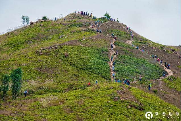
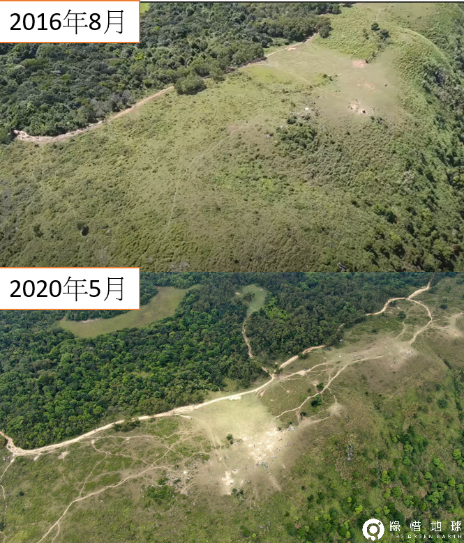
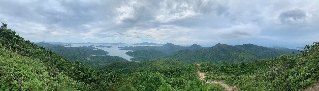
Ma On Shan - Ngong Ping
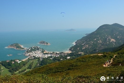
Ngong Ping is one of Hong Kong’s rare plateau, situated at an elevation of 400 meters. Its vast, open landscape offers breathtaking views, making it a popular destination for outdoor activities such as picnicking, camping, and paragliding.
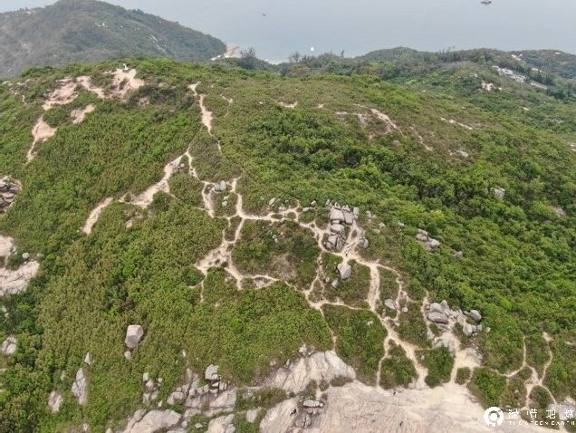
Nearby, Section 4 of the MacLehose Trail experiences heavy usage, as it serves as a key route for hikers. Additionally, the northern peak "Pyramid Hill" has become an increasingly sought-after peak in recent years.
 |
 |
Whether on the plateau or nearby trails, heavy foot traffic in recent years has led to noticeable environmental degradation. Even with the return of the wet season, vegetation and topsoil struggle to naturally recover, unable to regain their former lush greenery. (Photo taken in May 2020)
 |
 |
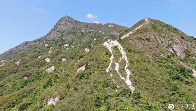
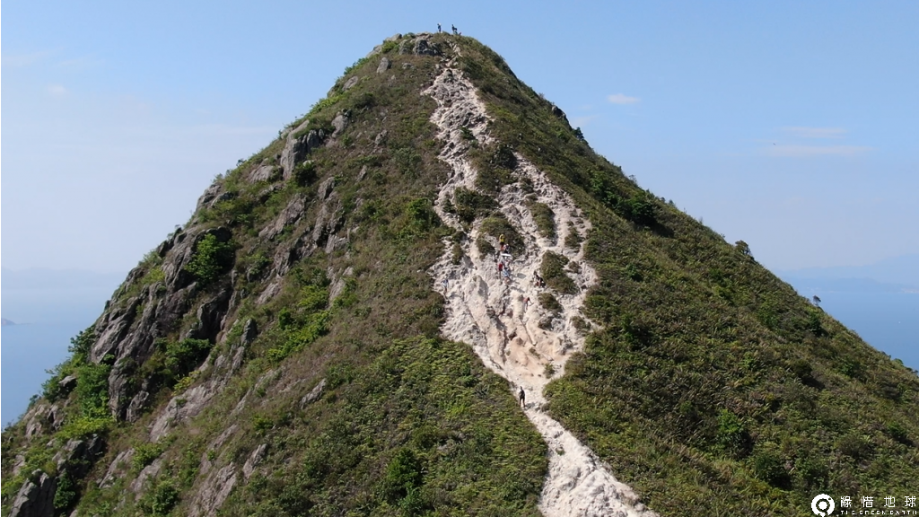
Sharp Peak
|
Sharp Peak is one of Hong Kong’s most challenging mountains, often regarded as the toughest of the "Three Sharp Peaks of Hong Kong." Many hikers see it as a true mountaineering test.
Due to its steep terrain, rainwater follows the hikers’ footsteps, causing rocky gullies that make the path increasingly difficult to walk. As a result, hikers often stray onto vegetated areas for an easier climb. However, once the plants are trampled and destroyed, erosion worsens, expanding the trail degradation. This ongoing cycle makes Sharp Peak one of Hong Kong’s most visibly deteriorating mountain paths.
|
 |
 |
The steeper the slope, the stronger the force of water erosion. Once erosion begins on a steep mountain, it rapidly worsens. Without timely intervention and proper restoration, recovery becomes incredibly difficult, often leading to permanent damage to the trail and surrounding landscape.
 |
 |
How to Hike Without Leaving a Trace?
During the pandemic, Hong Kong's countryside became a sanctuary for physical and mental well-being, offering residents a much-needed escape. It’s heartening to see people embracing outdoor activities and reconnecting with nature. While crowds are inevitable, fostering a strong awareness of environmental protection is even more crucial.
Instead of seeking momentary joy or the perfect social media shot, we should work together to ensure that Hong Kong’s natural beauty and outdoor resources remain intact for generations to come. Supporting sustainable trail management and adopting Leave No Trace hiking practices are essential steps in protecting these landscapes.
What can I do?
◎ Avoid creating unofficial trails
◎ Do not damage plants for photos
◎ Assess trail difficulty before hiking; do not force entry into challenging routes
(Pulling on small plants for support or sliding downhill can accelerate erosion.)
◎ Hold group activities in areas that can withstand heavy foot traffic
◎ Join volunteer programs to help restore hiking trails
Photo Credits